 161 Page views
Published on Fri Sep 06 2024 | Hindustan Times Ghaziabad Ghaziabad Development Authority (GDA) Modinagar Muradnagar Meerut Regional Rapid Transit System (RRTS) Duhai Loni
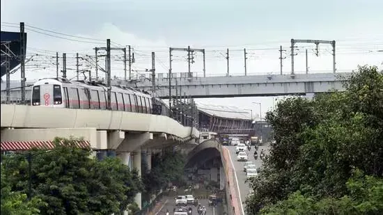
Officials said the plan has been drawn up to cater to the needs of an estimated population of 4.81 million by 2031, this is as per the estimates of NCR subregional plan, 2031.
The board of the Ghaziabad Development Authority (GDA) has approved the GIS-based draft of Unified Master Plan-2031 for Ghaziabad, Modinagar/Muradnagar and Loni during a meeting held in Meerut on Friday. Officials said the plan will now be sent to the state government for final approval and notification.
A master plan is a board layout of a city that clearly defines different areas as per land uses such as residential, commercial and industrial, among others, and outlines a set of plans for its development over a period of time.
The new plan will act as a blueprint for an area of about 32,302 hectares with 39.85% reserved for housing development, 4% for commercial and mixed land use, 10.68% for industrial, 19.67% for recreational/entertainment, and 12.79% for transport facilities, among others.
“The draft plan was approved by the board on Friday and we will soon send it to the state government for final approval. All required modifications sought by state-level committee and the transit oriented development (TOD) zones were also incorporated in the draft plan before approval,” said Atul Vats, vice-chairperson, GDA.
Officials said the plan has been drawn up to cater to the needs of an estimated population of 4.81 million by 2031. This is as per the estimates of NCR subregional plan, 2031.
This time, the draft plan also includes TOD zones in a 1.5km radius of eight Regional Rapid Transit System (RRTS) in Ghaziabad, and this encompasses an area of about 4261.43 hectares.
The plan also includes TOD zones along 10 Metro stations in Ghaziabad and covers 500 metres on either side of the stations. These TOD zones have combined area of about 482.63 hectares alongside the Red Line corridor with eight stations and another 153.98 hectares alongside the Blue Line corridor with two stations.
The TOD zones will provide for mixed land use -- residential along with commercial facilities and a higher floor area ratio (FAR) of 5, for vertical expansion.
“An area of about 909.82 hectares near the RRTS Duhai Depot and Duhai stations has also been defined as special development areas in the master plan. The plan also earmarks 100 hectares for logistics parks in Loni and Duhai for provision of better transport services. There are also plans for multimodal logistics park in Ghaziabad. The plan also provides for truck parking facilities near Tila Morh, Morta and Bhojpur while a river front has also been proposed along river Hindon,” said a GDA official, asking not to be named.
The officials said that the entire unified draft plan for Ghaziabad, Loni and Modinagar/Muradnagar has been divided into 15 zones and their zonal plans will also be chalked out in a phased manner.
SDS NRI Township: Homebuyers seek Yeida CEO’s help in property registration
Mumbai Metro Line 4 from Kasarvadavali to Wadala: trial runs to begin shortly, passenger service by end of 2025
Good News For Greater Noida Residents! Aqua Metro Line To Be Expanded Soon With 11 Stations
Eight-hour traffic jams in Delhi suburb as rains wreak havoc
Sarai Kale Khan-S Delhi corridor planned to decongest Ring Road